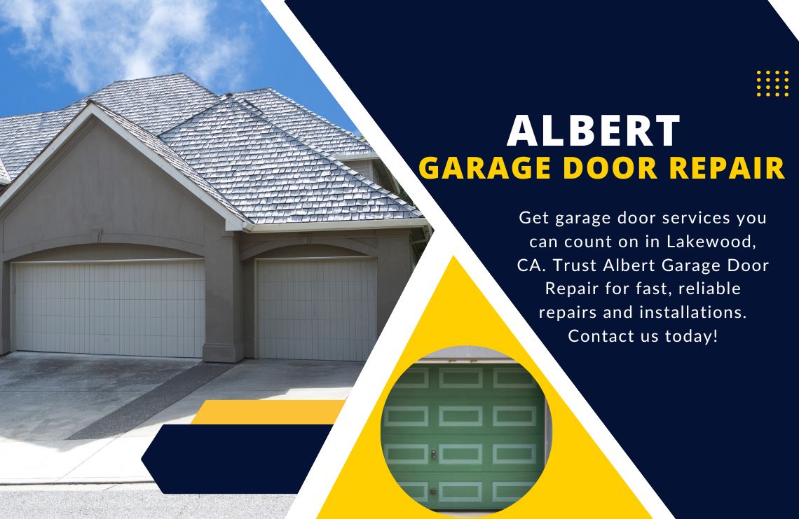
|
Estimating wind gusts for
airports not serviced by a TAF

Transitioning from the summer to autumn not only
means lower freezing levels and icing, but it also means strong winds
aloft and at the surface. When these strong winds move over
rough terrain, they can make every landing attempt a challenge.
This is especially true when the winds are also gusty.
So it is important that pilots keep a close eye on the latest
weather reports and forecasts available. Meteorologists at
the NWS Weather Forecast Offices (WFOs) issue Terminal Aerodrome
Forecasts (TAFs) four times a day and play a critical role in keeping
pilots aware of how strong the winds might gust. But what
about a forecast for wind gusts at and airport where the NWS doesn't
issue a TAF? No problem. Here are some tips on how to
estimate wind gusts at your
local airport.
One of the more useful weather products for
estimating wind gusts is the Model Output Statistics (MOS) guidance.
In fact, the forecaster at the local WFO (pictured to the
left) can take the MOS forecast to construct the TAF in its entirety.
Of course, the forecaster doesn't actually do this, but does
use the MOS guidance to help determine the visibility, ceiling and
winds for the terminal area over the 24 or 30 hour forecast period.
The guidance from the GFS Local Aviation MOS Program (LAMP)
is just one of several MOS products available. The GFS
LAMP is updated hourly and provides an hourly forecast through
25 hours for sensible elements such as temperature, dewpoint, wind,
ceiling height and visibility, just to name a few.
Using the GFS LAMP guidance can be a great way for a pilot
to estimate the winds (speed, direction and gusts) at an airport not
serviced by a TAF. In addition to the 600+ airports where the
NWS issues a TAF, there are hundreds other general aviation
airports to choose from. Click here to see the complete
list of stations provided by the GFS LAMP.

As an
example, let's take a look at a
recent terminal forecast where the winds
were
expected to gust. On the right is the 1200 UTC terminal forecast
for Charlotte Douglas Airport (KCLT) issued by a meteorologist at the
Greenville-Spartinburg (GSP) WFO. Notice that between 1400
UTC and 1800 UTC the winds are forecast to be northwesterly at 13 knots
with gusts to 20 knots with just a few clouds at 5,000 feet.
Below is the 1100 UTC GFS LAMP guidance
for Charlotte Douglas Airport (KCLT) valid from 1200 UTC October 18th
through 1200 UTC October 19th (or 25 forecast hours). This includes a forecast for
surface temperature in °F (TMP), surface dewpoint in °F (DPT), wind
direction in tens of a degree (WDR), wind speed in knots (WSP) and wind
gusts in knots (WGS) for KCLT. Other parameters such as
ceiling and visibility have been omitted for brevity, but are available
in the full GFS LAMP bulletin.

The meteorologist at GSP likely took a
peek at the GFS LAMP guidance before issuing the terminal forecast
above. After the header, the UTC time is shown in the first
row. This is followed by temperature, dewpoint, wind
direction, wind speed and wind gusts (NG means no gust) in subsequent
rows.
Notice that between 1500 UTC and 2200 UTC, the GFS LAMP
predicts the winds to be out of the northwest or 340 degrees.
During this timeframe the wind speed varies from 10 knots to 12 knots.
Between 1600 UTC and 2100 UTC, the winds are expected to gust
between 17 and 19 knots.
While this doesn't exactly match the
TAF, it is reasonably close. The biggest difference is that
the forecaster is expecting the winds will begin to gust at 1400 UTC,
lasting through 1800 UTC. Whereas the GFS LAMP isn't
predicting the gusts to start until 1600 UTC, but persisting through 2100
UTC. As it turned out, the TAF
forecaster was right on the money to predict gusty winds earlier in the
forecast as can be seen by the METARs from KCLT valid at 1400 and 1500
UTC.
KCLT 181452Z 35013G17KT 10SM
FEW040 SCT090 SCT200 11/01 A3016 RMK AO2
KCLT
181352Z 34011G17KT
10SM FEW040 SCT090 SCT250 09/02 A3015 RMK AO2
Early in the morning the sky was essentially clear with
just scattered clouds around Charlotte. According to the 1200 UTC
TAF, the sky is expected to remain scattered throughout the afternoon.
At 1449 UTC, the forecaster amended the KCLT TAF to add a broken
ceiling and extend the gusty
winds through 2200 UTC.
KCLT
181449Z 1815/1912 34010G20KT P6SM FEW040
FM181600 34013G20KT
P6SM BKN050
FM182200 35010KT P6SM SCT060
FM190400 34004KT P6SM SKC=
This unfortunately wasn't much of an
improvement to the original TAF since the
winds tended to be only marginally gusty during the afternoon as shown
in the KCLT METARs below. The sky did become more broken to
overcast in the afternoon. An overcast sky tends to dampen the
mixing in the boundary layer which ultimately can tone down the wind
gusts.
KCLT 181552Z 36008KT 10SM
OVC044 11/01 A3017 RMK AO2
KCLT
181652Z 35010G16KT
10SM OVC048 11/01 A3016 RMK AO2
KCLT 181752Z 33006KT 10SM
BKN045 OVC050 12/01 A3015 RMK AO2
KCLT
181852Z 33009KT 10SM BKN045 BKN055 12/01 A3013 RMK
AO2
KCLT 181952Z 34011G15KT 10SM
BKN049 12/01 A3014 RMK AO2
KCLT
182052Z 35006KT 10SM BKN060 13/01 A3015 RMK AO2
KCLT
182152Z 02009G15KT
10SM BKN060 BKN090 12/02 A3017 RMK
AO2
|